Uncertain Waters: Deltaic Interventions in Bangladesh amid Precarious Conditions
Skip other details (including permanent urls, DOI, citation information)
: This work is licensed under a Creative Commons Attribution-NonCommercial-NoDerivatives 3.0 License. Please contact [email protected] to use this work in a way not covered by the license.
For more information, read Michigan Publishing's access and usage policy.
Abstract:
Southwestern Bangladesh is a delta crosscut by a system of raised earthen embankments designed to keep multiple rivers from flooding the agricultural lands where most of the country’s population lives. Known as “polders,” the embankments were built beginning in the 1960s with the stated intent of preventing catastrophic flooding. Since then, they have required almost continual reinvestment, as seasonal storms, monsoon rainfall, and development activities erode polder walls every year, causing rivers to blast through containment zones and flood low-lying villages. Water is a perennial concern. More recently, as climate change comes to dominate the way international development agencies and global policy makers frame Bangladesh’s environmental problems, longer histories of human interventions into precarious deltaic landscapes are overshadowed by a single version of hazard. By drawing on ethnographic research and archival sources, this essay aims to unpack what sustainability means in a context of uncertain weather, unstable landscapes, and dynamic human social and environmental interactions, ultimately urging for increased attention to a history of human fashioning of deltaic lands.
Sites and Sights
Shipsha, Kapotokko, Buribhodra—all are southern offshoots of their more famous counterparts: the Meghna, Padma, and Jamuna Rivers. These waterways mark the culmination of flows that begin in the Himalayas and the Tibetan plateau, cutting a course through the subcontinent and emptying out into the Indian Ocean through Bangladesh. In the country’s southwest region, tidal rivers rise and fall each day on a regular schedule. Such constancy extends through the different seasons, each bringing with them their own set of social and ecological concerns.
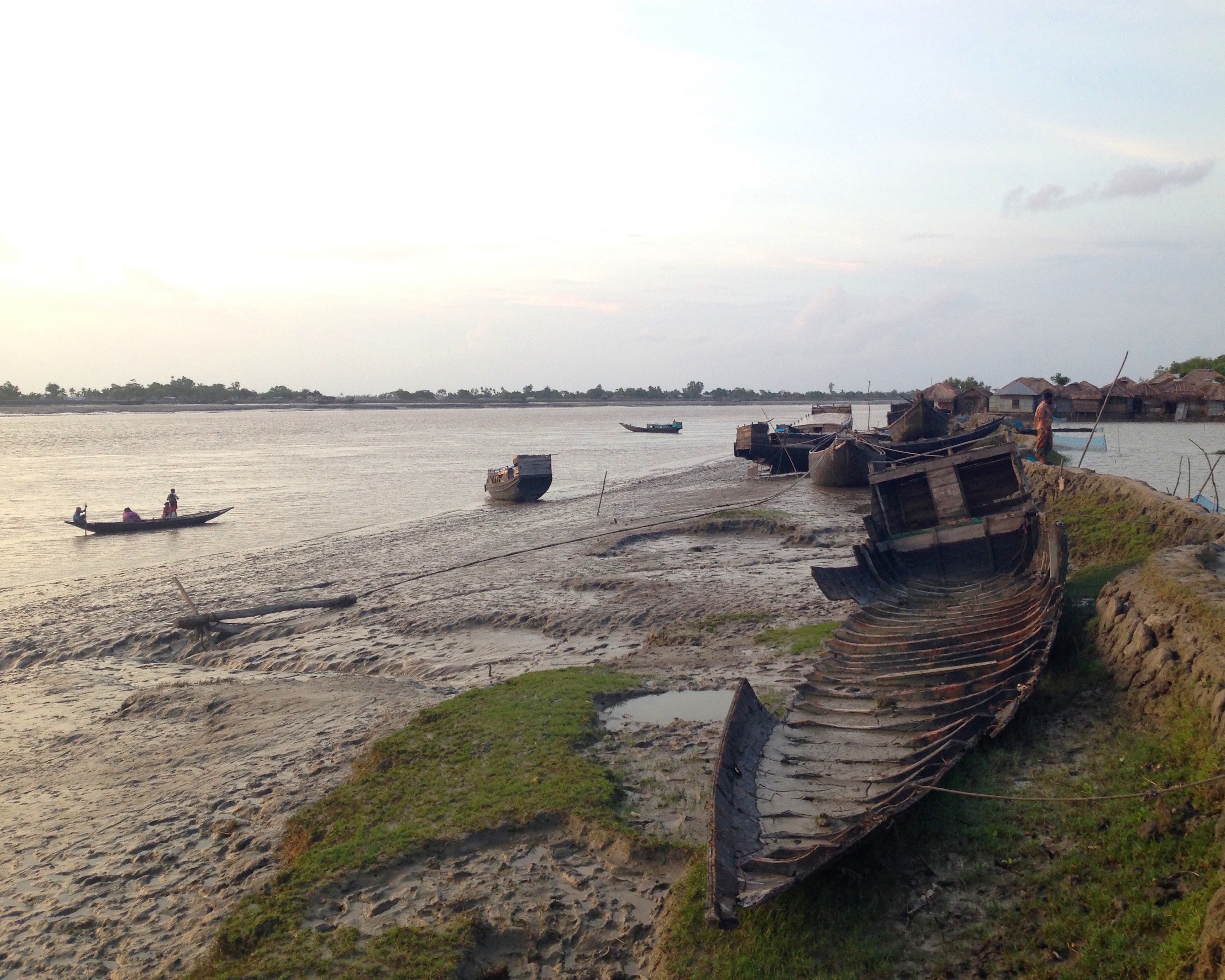
During periods of heavy rainfall, silt-filled riverbeds swell with water, causing the rivers themselves to behave erratically. With the increase in volume, they push against the manmade earthen embankments that crosscut southwest Bangladesh. The embankments are a visual and material reminder of the purposeful human reshaping of the delta. Sometimes the banks hold, but sometimes they give way, crumbling to unleash a devastating volume of water into containment areas that house multiple villages, agricultural fields, bazaars, and other spaces where people live and work. This kind of waterlogging can be catastrophic, submerging homes and lands sometimes for months as resources are mobilized to rebuild retaining walls. What does sustainability mean in a place where both a history of human interventions into the deltaic landscape as well as seasonal weather variation contribute to perennial precariousness?
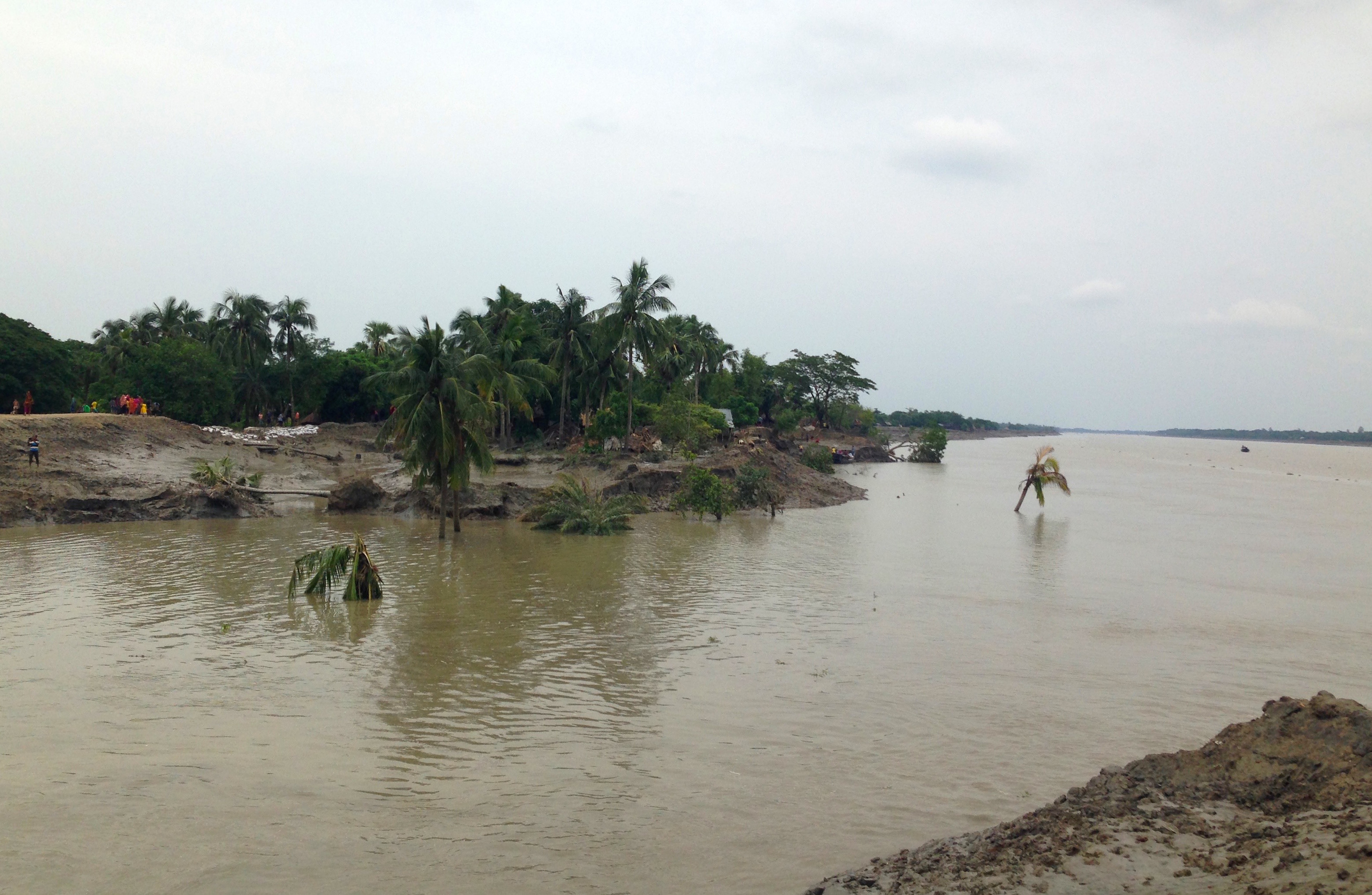
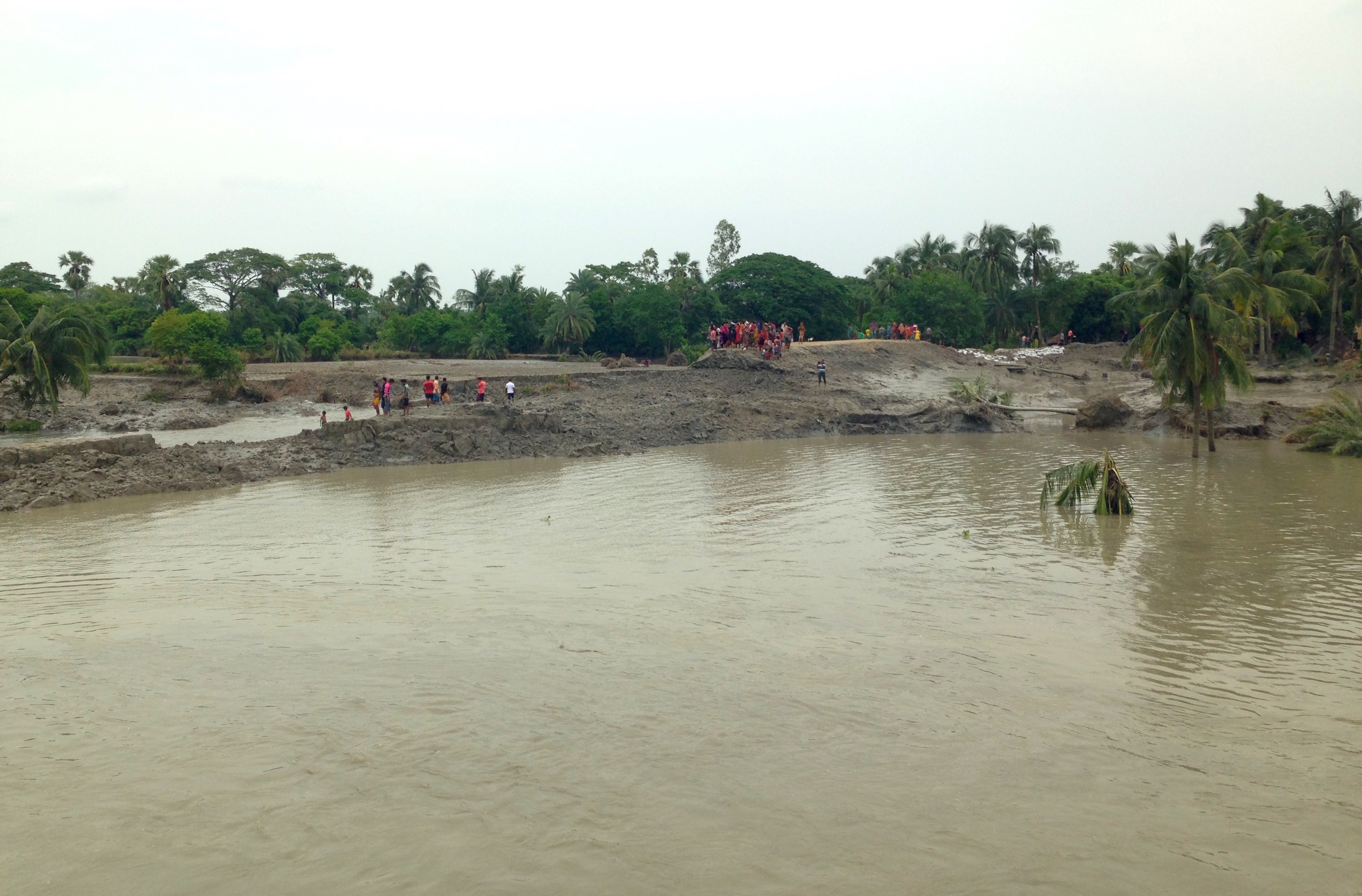
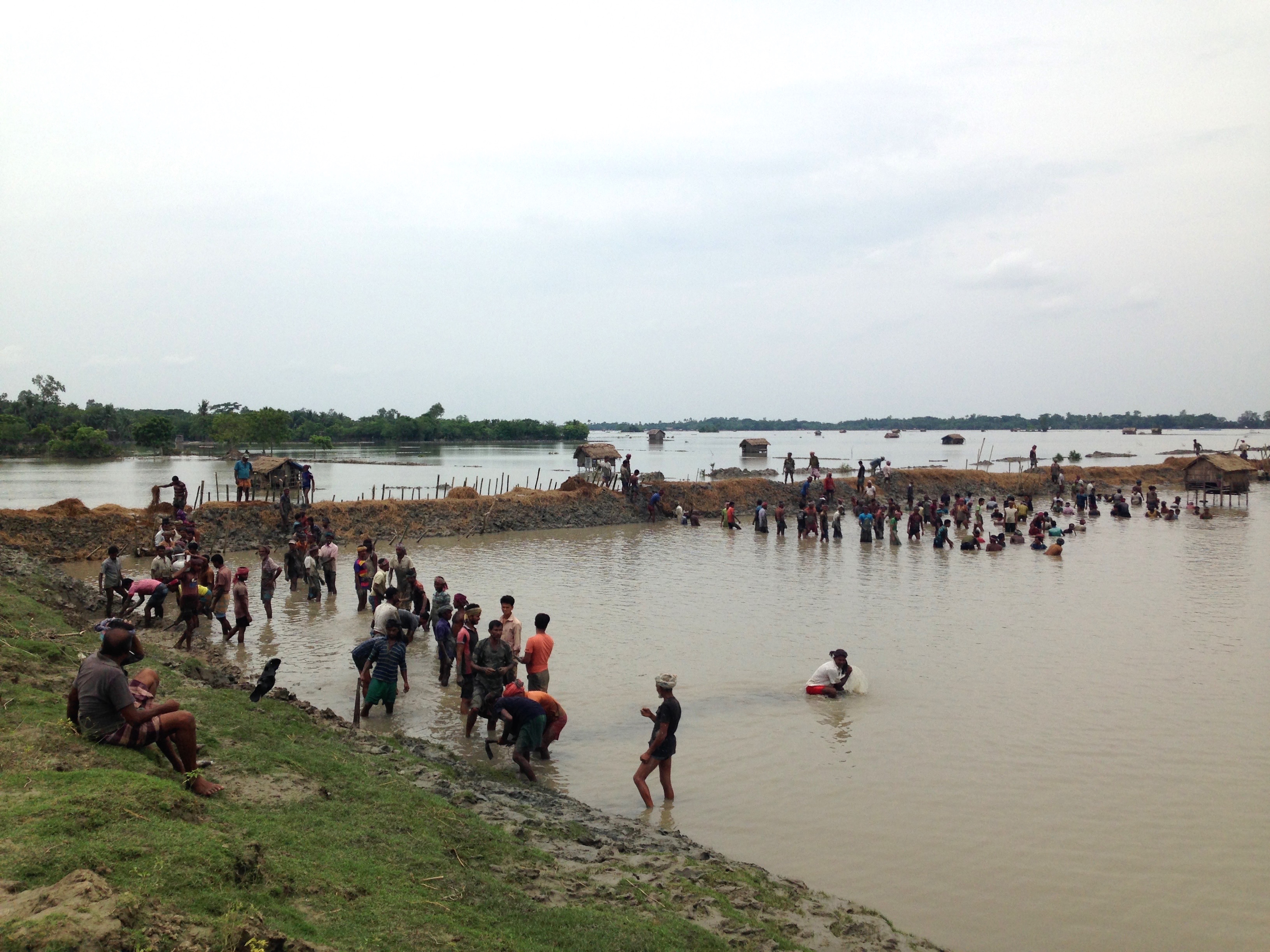
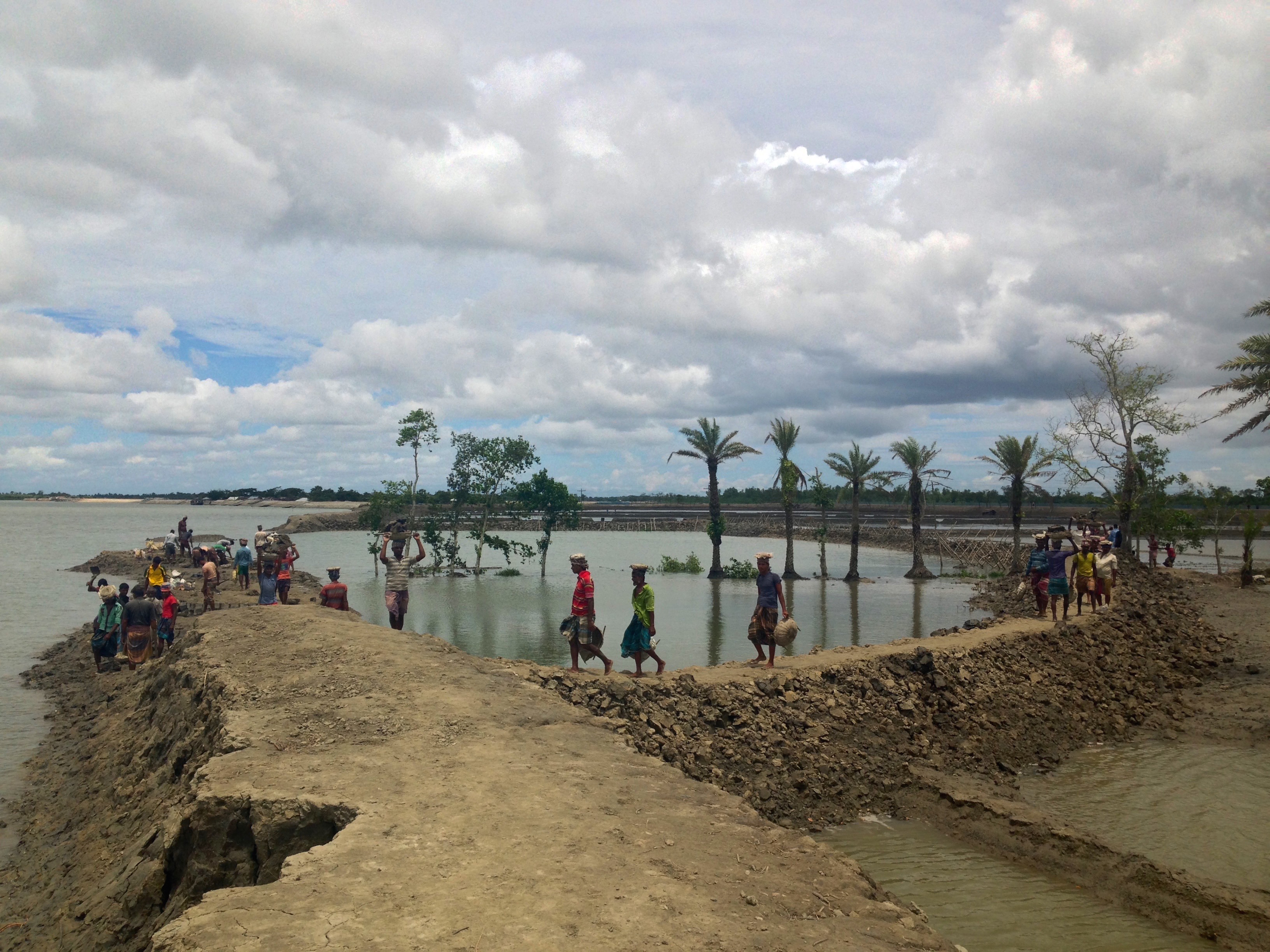
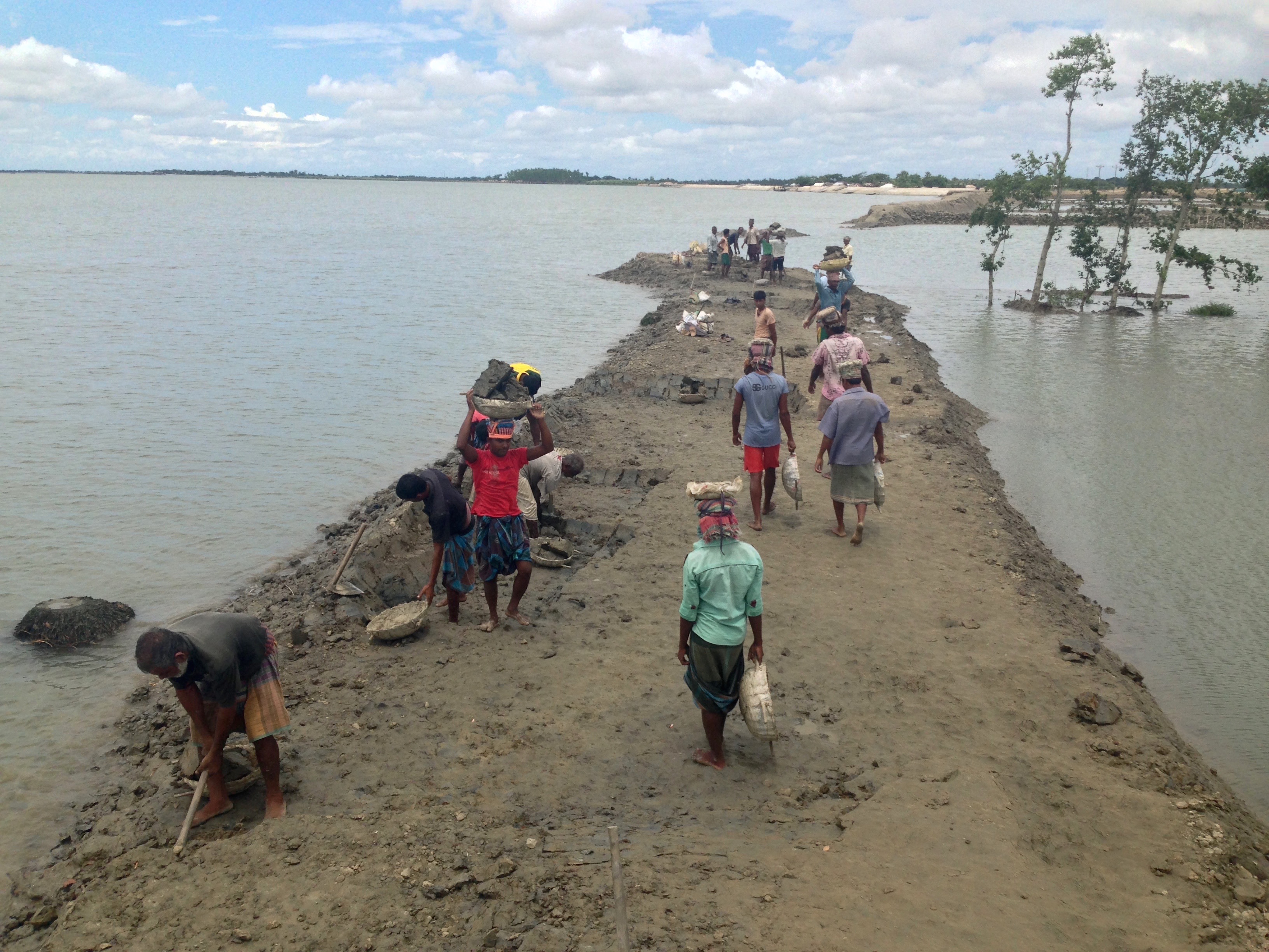
On an overcast day in August 2015, Asif Bhai[1] and I stood at the top of a recently eroded embankment 18 feet above the high tide line and surveyed the damage along with area residents and members of a regional activist NGO.[2] We were in Jhumkinodi Upazila in Bangladesh, where two weeks previously the Buribhodra River came crashing through the weakest part of an earthen wall as it was worn down by the monsoon rains. To cope, residents of the lowest lying villages within the flooded zone, including Asif Bhai and his extended family, had constructed temporary shelters on the adjacent roadsides, the only higher ground available. Taking wooden bedframes from their houses up to the road to use as platforms, area occupants strung up plastic sheeting as makeshift roofs to protect themselves and their belongings from the water pouring in from the sky and creeping up from the river. Asif Bhai lamented the current state of affairs, which he knew would remain uncertain until the local elected chairman was able to secure funds for rebuilding from the state government. In the meantime, Asif and other volunteers, mostly young-to-middle-aged men from the surrounding villages, were building a new containment wall about half a mile away from the original breach. None of them are strangers to this kind of waterlogging. The last major flood here happened ten years ago, but they emphasized the regular occurrence of smaller inundations. The floods disrupt the lives and livelihoods of men, women, and children living in the riverine southwest in myriad ways. Agricultural activities are necessarily put on hold, rice cultivation for domestic markets and household consumption may be upended for an entire growing season, schools are temporarily closed, and day laborers are unable to pursue their normal work and thus cannot earn regular wages for themselves and their families.

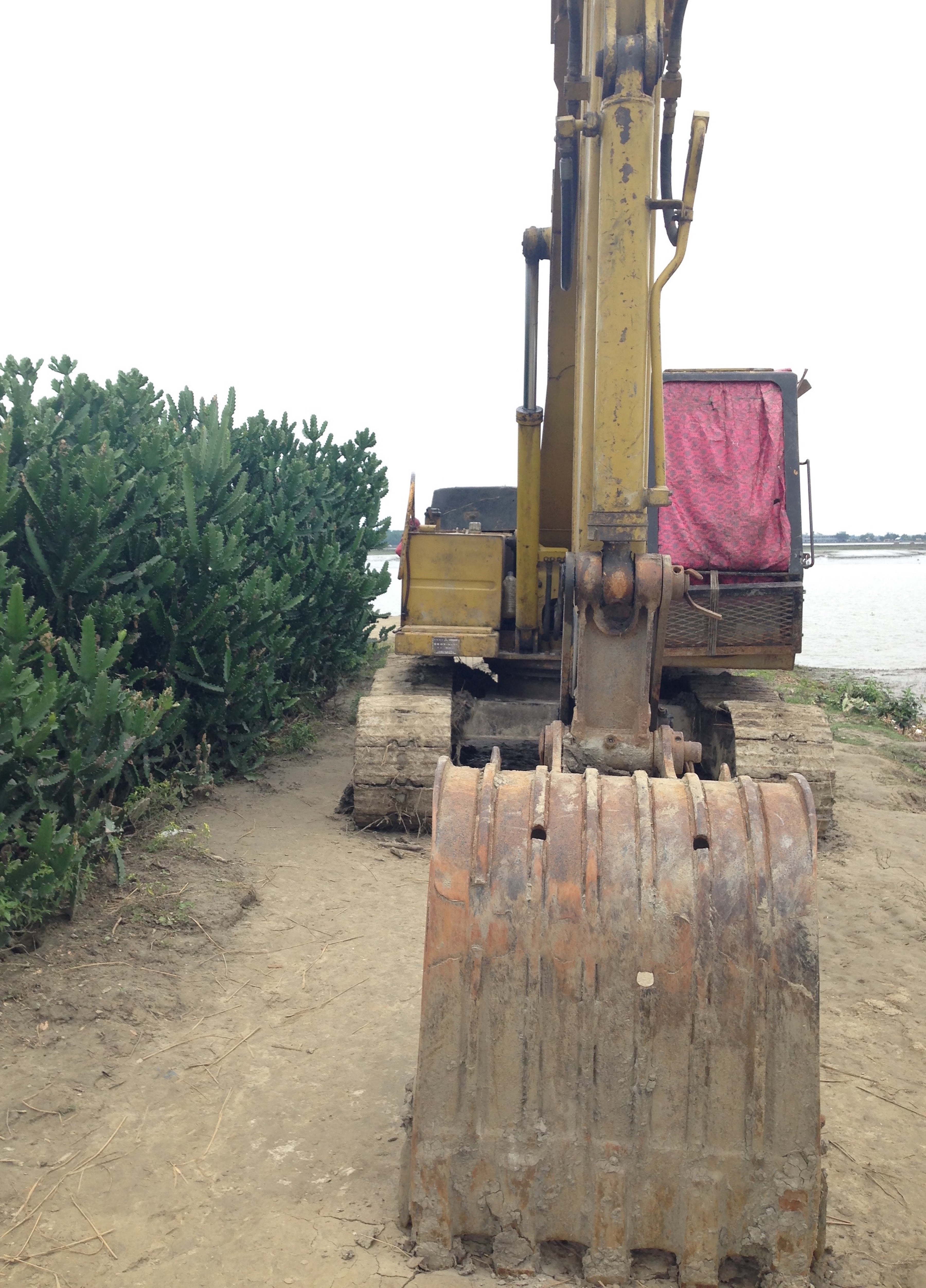
Remaking the Landscape
The submerged site is home to multiple villages and sits inside of one of the 123 areas in southwest Bangladesh encircled by earthen embankments, known as polders, which are the product of a series of state and international donor-funded infrastructural interventions into the country’s southern landscape. Following three major floods between 1954 and 1956, the government of what was then East Pakistan assembled a United Nations team of experts to assess the current damage and make recommendations for what to do about the problem of excess water. Led by the former United States Secretary of the Interior, Julius A. Krug, the team issued a report in 1957 encouraging the development of a system of embankments between the large riverways and the lands they abut across southwest Bangladesh. Despite their bold proposal, the commission urged proceeding cautiously, noting that embankments can be “vulnerable to attack by the rivers and (if of insufficient height) to being overtopped” (Krug 1957 [2010]: 251). By the early 1960s, polder construction—funded in part by USAID and the World Bank—was underway, even as some engineers cautioned against the potential negative social, economic, and ecological impacts of the program (Adnan 2009: 108). Indeed, today an understanding of how social, economic, and environmental processes are intertwined to form the “three pillars of sustainability” is widely agreed as necessary for conceptualizing sustainable development in the first place (see, for instance, the Intergovernmental Panel on Climate Change’s Fifth Assessment Report, Fleurbaey et al. 2014: 292).
By 1990, most of southwest Bangladesh, where over 30 million people were living, was enclosed by 7,555 kilometers of embankments (Thompson & Sultana 1996: 1). Even as they were being built, floods continued to plague the riverine rural and coastal areas the polders were built to protect. The sediment and silt that the river system carried downstream would clog the sluice gates designed to maintain a controlled flow of water between the inside and outside of a given polder. Erosion constantly thwarted efforts to secure and bring order to the landscape and, by extension, the lives of those residing there. Polder construction in Bangladesh began as a modernizing project of the 1960s, similar to other contemporaneous state and international development-sponsored experiments in ostensible risk reduction, like those of the Green Revolution that made high-yielding seeds and chemical technologies widely available. (Muhammad 2004: 3447). While intended to bring stability to an uncertain conjuncture of social, environmental, political, agricultural, atmospheric, and economic phenomena, the polders became a system in need of almost continuous upkeep and renewed investment.
In response to further flooding affecting millions of people in the late 1980s, the World Bank published the Flood Action Plan for Bangladesh, explicitly stating that “economic justification of flood control rests more on the enhancement of land use than on the reduction of flood damage” (World Bank 1990: 4). This claim, which gave economic concerns precedence over socio-environmental factors, as well as other aspects of the plan—including embankment construction on the banks of Bangladesh’s largest rivers—came under censure at the time (Boyce 1990, Custers 1993). By the late 1990s, larger infrastructural undertakings fell out of favor, and government officials advocated for smaller-scale projects in the National Water Management Plan (Brammer 2010: 119). Flooding in the Bengal Delta has been a longstanding problem with widespread social, economic, and governmental consequences in the region from the time the lower delta was settled during the Mughal and British colonial periods. Contemporary attempts to protect productive land and the inhabitants who live and work on it need to take into account the lived experiences of those who deal firsthand with the vagaries of the seasons, weather, water, and landscapes. They are the ones who assess and live with both the immediate and long-term effects of projects and interventions large and small. As the intended beneficiaries of flood protection plans, the people who reside and work in the southwestern deltaic environment can be better engaged in partnerships for collectively considering local and regional solutions to the problems borne of unstable ecologies.
Managing Uncertainty
As climate change emerges as the primary paradigm for conceptualizing environmental risk in 21st-century Bangladesh, those who live in the riverine southwest are made to answer questions about sustainable futures posed by international donors, NGO personnel, climate scientists, anthropologists, and aid workers, among many others. Bounded schematics of contemporary social action denoted as “adaptation,” “mitigation,” and “loss and damage” cannot account for the multiplicity of ways in which people manage and live with uncertainty: predicting the future and taking action in the present given their past experience, demanding resources from the various agencies that endeavor to interpellate them as constituents, and maintaining daily life amid precarious conditions. The ability to respond to and cope with disturbances of various kinds, sometimes referred to as socio-ecological resilience (see, for example, Folke 2006), highlights the tenacity of communities, villages, and individuals in the face of great upheaval. Resilience tends to connote the capacity of a system to bounce back from a disastrous event. But what if the possibility of catastrophe is regular and recurrent, not necessarily linked to a particular event, but rather heightened by seasonal conditions? Seeing sustainability at the interstice of variable weather, dynamic ecologies, land that the human hand has consistently cultivated and remade, and anxious governmental intervention necessitates a historical understanding of place and the conditions of possibility that have brought into being what we see now in southwest Bangladesh.
References
- Adnan, Shapan. 2009. “Intellectual critiques, people’s resistance and inter-riparian contestations: Constraints to the power of the state regarding flood control and water management in the Ganges-Brahmaputra-Meghna Delta of Bangladesh” in Water, Sovereignty, and Borders in Asia and Oceania, Devleena Ghosh, Heather Goodall, and Stephanie Hemelryk Donald, eds. London and New York: Routledge.
- Boyce, James. 1990. “Birth of a Megaproject: Political Economy of Flood Control in Bangladesh” in Environmental Management 14(4): 419-428.
- Brammer, Hugh. 2010. “After the Bangladesh Flood Action Plan: Looking to the future” in Environmental Hazards 9: 118-130.
- Custers, Peter. 1993. “Bangladesh’s Flood Action Plan: A Critique” in Economic and Political Weekly 28(29/30): 1501-1503.
- Fleurbaey M., S. Kartha, S. Bolwig, Y.L. Chee, Y. Chen, E. Corbera, F. Lecocq, W. Lutz, M.S. Muylaert, R.B. Norgaard, C. Okereke, and A.D. Sagar. 2014. “Sustainable Development and Equity” in Climate Change 2014: Mitigation of Climate Change. Contribution of Working Group III to the Fifth Assessment Report of the Intergovernmental Panel on Climate Change, Edenhofer, O., R. Pichs-Madruga, Y. Sokona, E. Farahani, S. Kadner, K. Seyboth, A. Adler, I. Baum, S. Brunner, P. Eickemeier, B. Kriemann, J. Savolainen, S. Schlömer, C. von Stechow, T. Zwickel and J.C. Minx (eds.). Cambridge and New York: Cambridge University Press.
- Folke, Carl. 2006. “Resilience: The Emergence of a Perspective for Socio-Ecological Systems Analyses” in Global Environmental Change 16: 253-267.
- Muhammad, Anu. 1994. “Waterlogged Again: Why Control Measures Have Not Worked” in Economic and Political Weekly 39(31): 3447-3449.
- Krug, J. A. 1957 [2010]. “United Nations Technical Assistance Programme, Water and Power Development in East Pakistan, Vol. 1. Report of a United Nations Technical Assistance Mission for the Water and Power Development Board in East Pakistan” in Water Resource Development in Bangladesh, Historical Documents. Salim Rashid and Rezaur Rahman, eds. Dhaka: The University Press, Ltd.
- Thompson, Paul M. and Parvin Sultana. 1996. “Distributional and Social Impacts of Flood Control in Bangladesh” in The Geographical Journal 162(1): 1-13.
- World Bank. 1990. Flood control in Bangladesh: a plan for action. World Bank technical paper. No. WTP 119. Washington D.C.: The World Bank.
Notes
In keeping with anthropological conventions, the names used in this essay are pseudonyms. Specific place names have been changed, with the exception of larger rivers and waterways.

The preliminary fieldwork upon which this photo essay is based was generously supported by the Social Science Research Council’s Dissertation Proposal Development Fellowship and by the Department of Anthropology at Stanford University.


